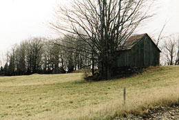
Between 1840 and 1850, Saint-Joachim residents were mostly Irish and French Canadian settlers who came to clear and live off the land. The two communities were at odds over the construction of a second Catholic church in the village. Through an eventual agreement, the parish was founded in 1858 and the municipality incorporated in 1884. It took the name Saint-Joachim-de-Shefford, indicating the township to which it belongs. You’ll find it on the scenic route, which leads north to Acton Vale. It provides many spectacular views, including large numbers of white-tailed deer in spring.
Saint-Joachim-de-Shefford
Sector Granby & region
Visitors' photos and videos
Local Weather
Attractions and Activities (14)
A Land of Plenty and Sugar shacks (1)
-
Érablière Leclerc
9.9 km
(6.14 mi)
Adventures and excursions (1)
-
Parc national de la Yamaska
8.9 km
(5.55 mi)
Beaches (1)
-
Municipal beach (Lake Waterloo)
13.6 km
(8.43 mi)
Cross-Country Skiing and Snowshoeing (1)
-
Parc national de la Yamaska
8.0 km
(5.00 mi)
Cycling trails and unmarked circuits (2)
-
Piste du circuit du patrimoine de Waterloo
12.2 km
(7.55 mi)
-
La Campagnarde
12.5 km
(7.79 mi)
Golf courses (1)
-
Golf Le Rocher de Roxton Pond
11.0 km
(6.82 mi)
Hiking (2)
-
Parc national de la Yamaska
8.9 km
(5.55 mi)
-
Centre d'interprétation de la nature du lac Boivin
13.6 km
(8.43 mi)
Museums and interpretation centres (1)
-
Centre d'interprétation de la nature du lac Boivin
13.6 km
(8.43 mi)
National Parks & Recreational Centres (1)
-
Parc national de la Yamaska
8.9 km
(5.55 mi)
Ornithology (2)
-
Parc national de la Yamaska
8.9 km
(5.55 mi)
-
Centre d'interprétation de la nature du lac Boivin
13.6 km
(8.43 mi)
Vineyards (1)
-
Vignoble Côte des Limousins
10.4 km
(6.46 mi)
Accommodations (5)
-
Camping Parc national de la Yamaska
8.9 km
(5.55 mi)
-
Motel & Chalets Waterloo
10.5 km
(6.54 mi)
-
Les Matins de Victoria
11.7 km
(7.28 mi)
-
O'Berge du Pignon
12.7 km
(7.87 mi)
-
Motel des Deux Lacs
14.1 km
(8.75 mi)
Tourist Information Offices (1)
-
Bureau d'accueil touristique de Waterloo
12.2 km
(7.59 mi)
Cacher
Sectors and municipalities
Tourism sectors
Municipalities in Brome-Missisquoi:
Municipalities in Des Sources:
Municipalities in Granby & region:
Municipalities in Haut-Saint-François:
Municipalities in Megantic:
Municipalities in Memphrémagog:
All municipalities
B
J
L
M
P
Q
S
- Saint-Adrien
- Saint-Alphonse
- Saint-Armand
- Saint-Augustin-de-Woburn
- Saint-Benoît-du-Lac
- Saint-Camille
- Saint-Claude
- Saint-Denis-de-Brompton
- Saint-Élie d'Orford (see Sherbrooke)
- Saint-Étienne-de-Bolton
- Saint-François-Xavier-de-Brompton
- Saint-Georges-de-Windsor
- Saint-Herménégilde
- Saint-Ignace-de-Stanbridge
- Saint-Isidore-de-Clifton
- Saint-Joachim-de-Shefford
- Saint-Ludger
- Saint-Malo
- Saint-Pierre-de-Véronne-à-Pike-River
- Saint-Robert-Bellarmin
- Saint-Romain
- Saint-Sébastien
- Saint-Venant-de-Paquette
- Sainte-Anne-de-la-Rochelle
- Sainte-Catherine-de-Hatley
- Sainte-Cécile-de-Milton
- Sainte-Cécile-de-Whitton
- Sainte-Edwidge-de-Clifton
- Sainte-Sabine
- Sawyerville
- Scotstown
- Shefford
- Sherbrooke
- Stanbridge East
- Stanbridge Station
- Stanstead
- Stanstead-Est
- Stoke
- Stornoway
- Stratford
- Stukely
- Stukely-Sud
- Sutton


