Take your pick: adrenaline packed or slow and contemplative?

Updated on Apr 14, 2025
Here is 5 beautiful lookouts you will find in the Eastern Townships.
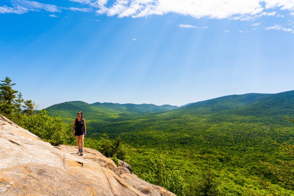
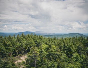
Considered as one of the hidden jewels of Mont-Orford, these footbridges on stilts offer you a breathtaking view of the region and its many lakes! Suspended between lakes and mountains, this circuit is taken by landings that lead you directly to the rocky cape overlooking the Appalachian mountain range. You can take advantage of these lookouts for a picnic stop or a well-deserved break!
How to get there: Once at the top, look for the antennas and take the trail on your left. Be careful not to confuse it with the 4km trail. The key clue: the right path will give you the impression that you are heading to the other side of the mountain. If you have followed the right path, you will find on your left between many conifers, the opening for the access to the footbridges. On your way back, enjoy a good beer from the Canton Brasse microbrewery, located in the heart of the village of Orford!
Mont Ham is 18 km of well-marked paths, a regional park and, especially a panoramic view that will take your breath away and have you discover our amazing region. Plan some extra time to relax when you have reached the summit … you won’t want to go back down! There’s nothing better than a mountain top picnic to reward yourself for all your efforts!
If you’re passionate about outdoor activities, why not camp on the summit and admire the magnificent sunset and sunrise. The next day, you could try their fitness trails by the foot of the mountain.
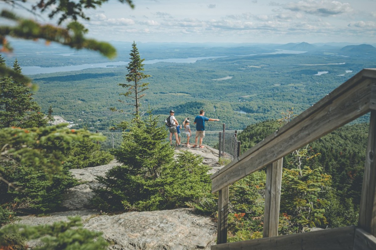
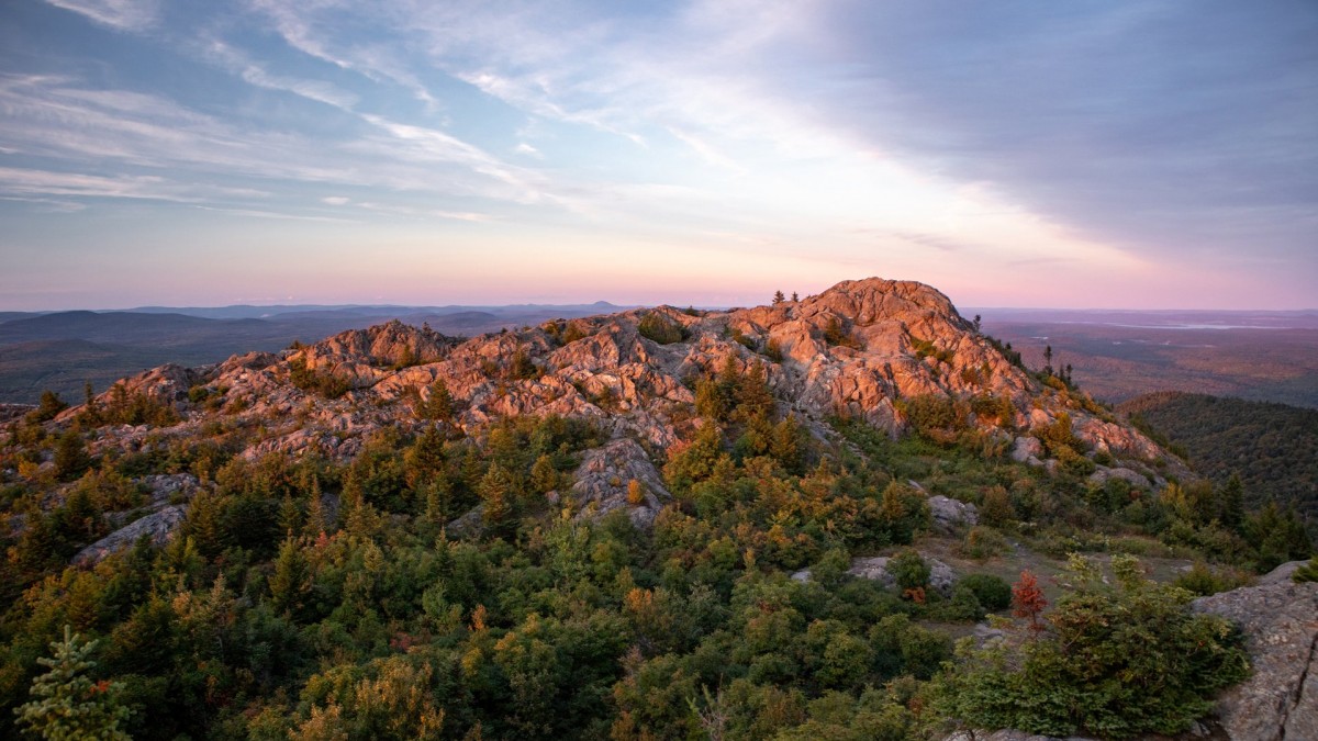
The trail of the Sentier des Cimes is located in the Franceville sector, in the North-West part of the Parc national du Mont-Mégantic. What makes this trail unique is that you’ll hike along a spectacular rocky ridge from the Franceville sector of the park all the way to the Pic de l’Aurore. With an altitude of 835 metres, it offers one of the most astonishing points of view in the Eastern Townships, from which you can spot the Mont-Mégantic Observatory and the highest peak of the Parc national du Mont-Mégantic.
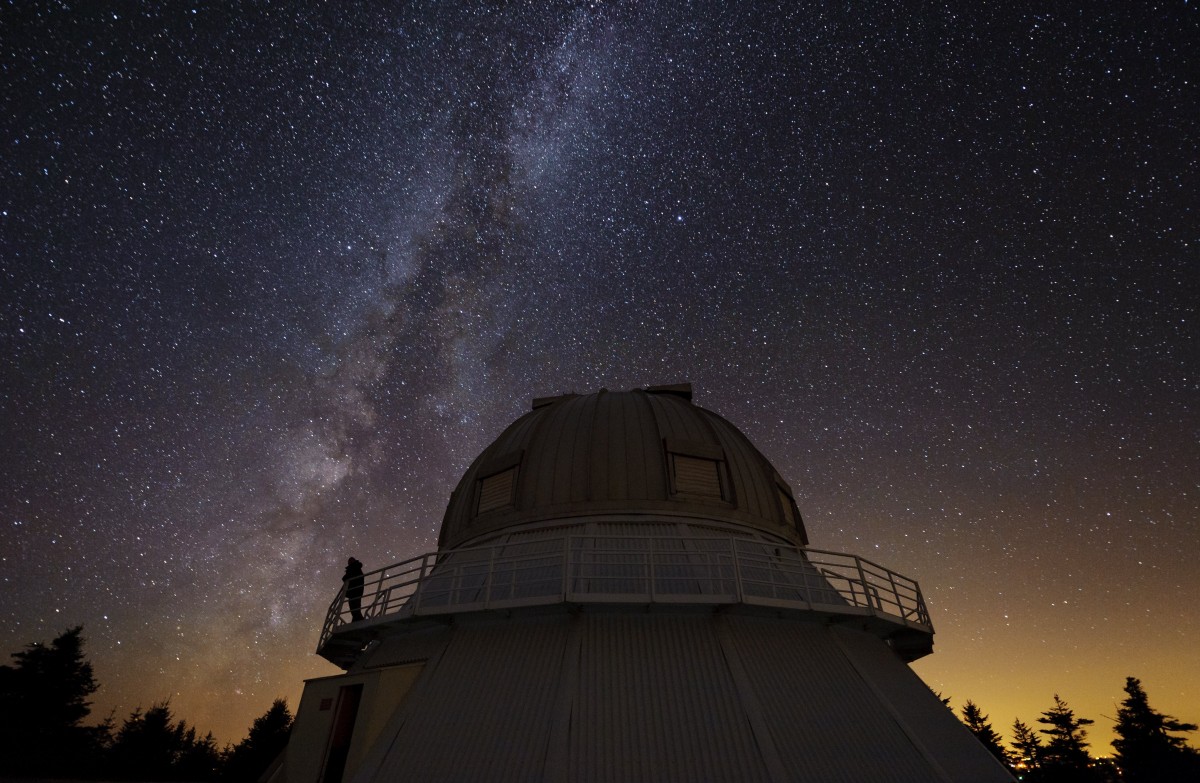
The observatory is set on top of Mont-Mégantic. It was inaugurated in 1978 and its telescope has a 1.6 m mirror; the observatory also uses many other high-precision tools. During the day, the observatory welcomes visitors and offers an interesting tour (exceptionally closed to visitors in 2025).
At an altitude of 1,100 metres, the landscape of this area is already quite impressive. However, when night sets in, the sky lights up magnificently as it reveals its billions of stars. Generally dedicated to research, the Observatoire Asrtonomique du Mont-Mégantic welcomes you only on certain evenings throughout the year. These are not-to-be-missed dates! Psst! If you can’t make it then, you can also visit the ASTROLab at the bottom of Mont-Mégantic.
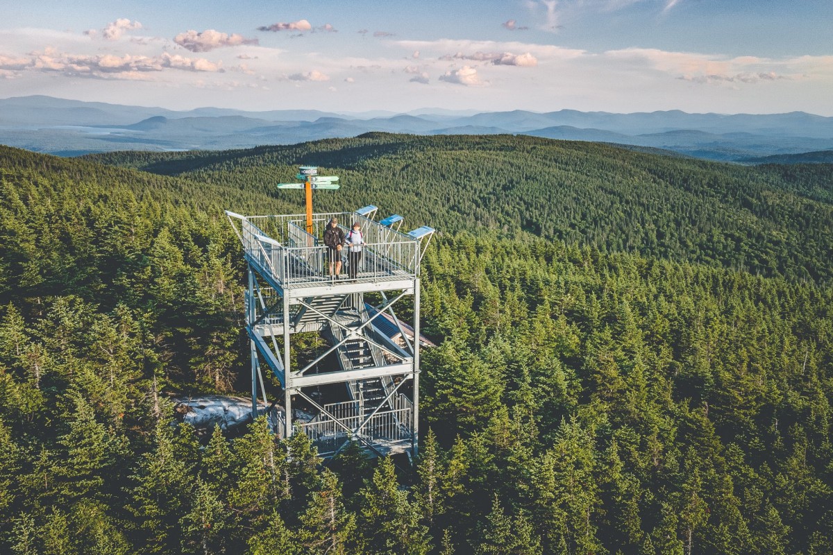
The trails of Mont Bélanger runs along the Canadian U.S. border and once you’ve reached the top, it offers a stunning view of both countries as well as of the Appalachian Mountain Range. You can also climb a six-metre-high tower, so imagine the panorama you’ll discover! You’ll find 6 stops on your way with other great views of the area.
As you walk along the trail, you’ll notice a remarkable flora and fauna as well as hear many different types of birds, such as the golden eagle, the Bicknell Thrush and the turkey vulture. Mont Bélanger also has impressive scree slopes, a 200-year-old forest and two biological refuges.
Nature, sports and outdoor activities
The Highest Summits of the Townships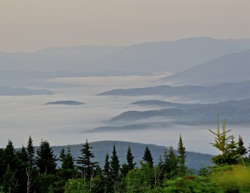
Nature, sports and outdoor activities
New Mountains to Discover!