X
Marker
De la Passe
(Saint-Robert-Bellarmin)
Leaflet Map data © OpenStreetMap contributors
SEE THE ITINERARY
Marker
De la Passe
(Saint-Robert-Bellarmin)
Leaflet Map data © OpenStreetMap contributors
SEE THE ITINERARY

De la Passe

Sentiers Mont Bélanger

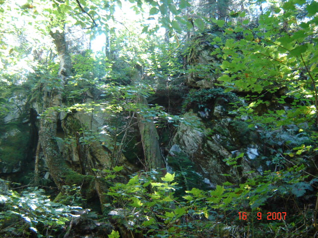
View of the talus and old-growth forest. You may cross deer along the way. You’ll discover flora, undergrowth, moss, and large trees. In certain areas, this trail follows the beginning of the old-growth forest. You can stop at the “Passe de l’ours” at 670 metres in altitude.

Departure

Parking at the Welcome Center

At the corner of Chemin de la Linière and Chemin du Club, St-Robert-Bellarmin

Technical specifications

Length : 7.4 km

Time : 3h

Linear (round trip)

Altitude : 800 m

Difficulty : Easy

  • Spring, summer, fall
  • Closed in hunting season
  • Winter Walk

  • Snowshoeing
  • Accessible in sport stroller
  • Accessible by wheelchair
  • In the mountain (with top)
  • In the forest, little rough
  • Urban
  • Interpretation of nature
  • Dogs permitted
Number of camping platforms on this trail
  • 0
Number of campsites on this trail
  • 0
Number of shelters on this trail
  • 0
X

Filters

X
Taste the Townships
Arts, culture and entertainment
Shopping
Lodging
Nature, sports and outdoor activities
Restaurants
Tourist routes
Family outing
Spa and wellness
Charging stations