Take your pick: adrenaline packed or slow and contemplative?

Updated on Jun 2, 2026
Here are six intermediate and difficult-level hiking routes for pros. They are wonderful treasures hidden in the area and will surely astound you as they offer you a good dose of adrenaline! Have a great hike!
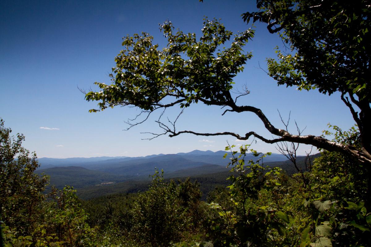
The three summits loop (boucle des Trois-Sommets) will take you to the top of Mont Saint-Joseph, Mont Victoria and Mont-Mégantic. The trail begins near the Discovery pavilion of the Parc national du Mont-Mégantic.
Throughout the course of your hike, you’ll discover magnificent points of view, and this, only a few minutes after you have started out. You’ll also pass by two popular observatories. Plus, you’ll be able to climb up two observation towers. The trails are easily accessible, but the overall loop surprises by its length.
Prepare yourself for a full day of hiking and discovering breathtaking landscapes.
Head out to the Potton Township, where you’ll find the Réserve naturelle des Montagnes-Vertes, which covers over 78 km2 of natural beauty, forests, maples and streams. It is a true nature paradise where 60 km of hiking trails via three networks are at your disposal.
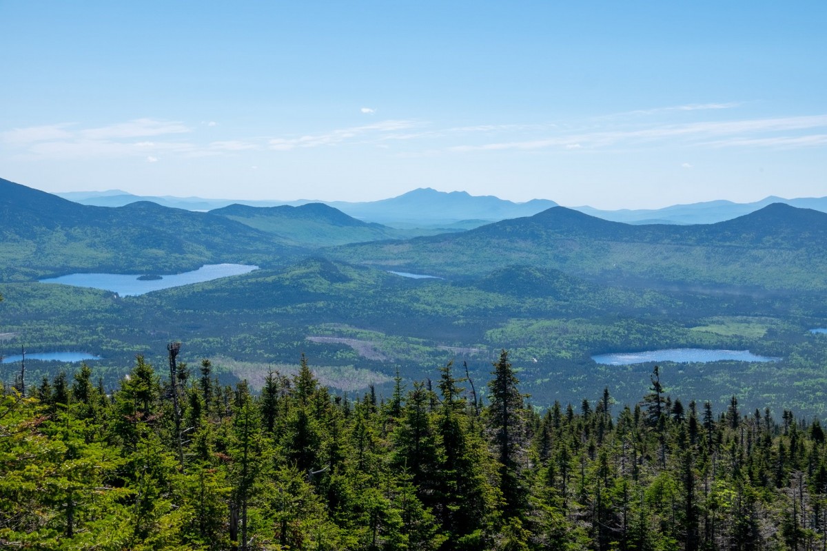
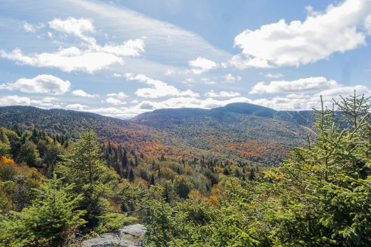
The sentier des Sommets, takes you to mount Singer, and is definitely the most beautiful of all their trails. When you reach the summit, you’ll discover an unbelievable panoramic view, revealing several mountains with elevations of 750 m and more. You’ll even be able to spot the Fullerton pond and a dam dating back to the 1900s. Have a great climb!
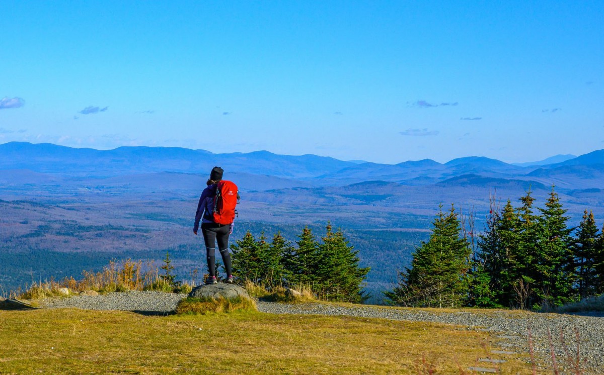
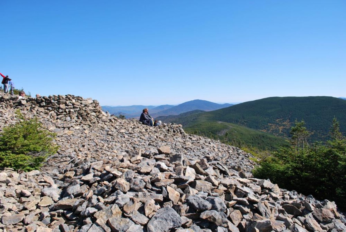
Mount Gosford is the highest peak of southern Quebec. With an altitude of 1,193 metres, it is an impressive mountain with just as impressive hiking trails as well. Leave your watch behind as you travel across Le défi des quatre sommets, which follows the Arnold River and heads to the Clearwater shelter where you can spend the night.
At Mount Gosford’s highest point, you’ll enjoy an exceptional view of mountains and forests as far as the eye can see. The loop can be completed in a total of 12 hours of hiking while you admire incredibly marvellous landscapes.
You don’t have enough time off to complete the long two-day hike? The summit loop of Mount Gosford, takes about 6 hours to complete, offering the most important attractions of the inhabited forest, and is just as impressive.
The Summit loop (la boucle du Sommet) allows you to reach the top of the mountain, to walk along the Arnold River and to encounter a magnificent flora. Don’t worry, this hike is also quite challenging and will surely take you outside of your comfort zone. Guaranteed fun!
The trail D'une douane à l'autre of the Sentiers frontaliers is a six-day trek, taking you through the highest mountains of the region as you discover panoramic views overlooking Canada and the United States. From the roadside halt of Chartierville to the Woburn customs, this trail will have you discover beautiful landscapes, impressive mountains and magnificent valleys. Eight-one kilometres of pure bliss!
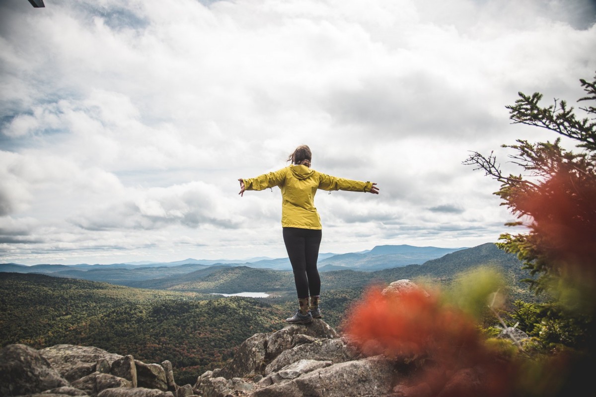
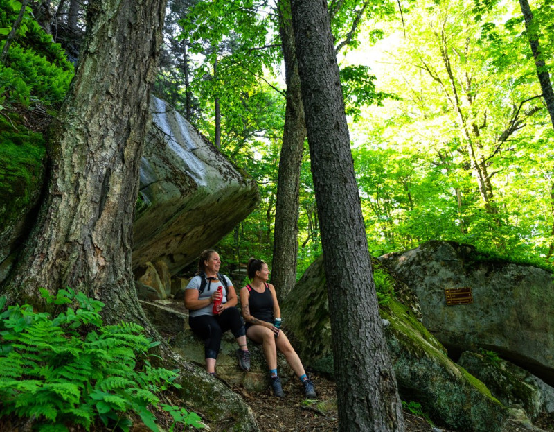
Once past the multiple lookout points of the Dos d'Orignal trail, you will reach an area where several century old birch trees are perched on erratic blocks crowed with ferns. This area is one of the oldest sections of the Estrie trail network. This demanding hike is worth the trip.
Nature, sports and outdoor activities
The Highest Summits of the Townships