Take your pick: adrenaline packed or slow and contemplative?

THINGS TO DO
Your Townships adventure starts here.
Sports, Nature & Outdoor Activities
Take your pick: adrenaline packed or slow and contemplative?
Arts, Culture & Heritage
Let your imagination run free at galleries, theatres, museums and workshops.
Spa & Wellness
Treat yourself to massages, body treatments, Nordic baths and other sensory delights.
Shopping
Scour our markets, boutiques and other hidden gems to score incredible finds.
Events
Discover our cultural vitality with a wide range of special events.
Cycling
The Townships is a great cycling destination, because it’s designed for pedal power - slow, contemplative, challenging or sporty.
Hiking Trails
Fill your pack with local flavours before setting off to explore the natural beauties that make our region so stunning.
Campgrounds
Abundant amenities in the heart of nature.
Tables Champêtres
A unique gastronomic experience in the heart of the region.
Golfing
Tee off in the Townships and get into the swing of things with 9 or 18 holes. Fore!
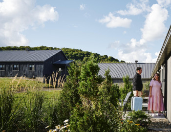
Where to stay
Lodging options to suit any taste and budget.
Hotels & Country Inns
Stunning locations and outstanding service come together for a bliss-inducing stay.
Bed & Breakfasts
Get up close and personal with life in the Townships.
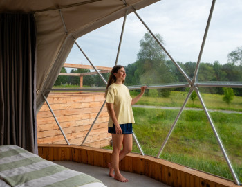
Off the Beaten Path
Think outside the box with out of the ordinary accommodations.
Cottages & Condos
Custom comfort near the city or in nature.
Campgrounds / RV Rentals
Abundant amenities in the heart of nature.
Vacation Centres
Kick back and relax as a family with all-inclusive vacation options.
Other Types of Lodging
Experience something different by choosing unique lodging.
Destination Spas
The only thing better than a day at the spa? Several days at the spa!
Hikers Welcome
If you, like thousands of visitors annually, plan on hiking in the region, know that your efforts will be rewarded by our world-class hospitality.
Bienvenue Cyclistes
Explore the region on two wheels and stay in one of the many accommodation options bearing the Bienvenue cyclistes icon.
Pet Friendly
Don’t want to leave your four-legged friend behind? Book a stay in some of the region’s many dog-friendly digs and you won’t have to.
The Townships
The Townships possess a rich heritage that you will discover everywhere on its nine territories, in its towns and villages, its Coeurs villageois, etc.
Not to be missed
What is it that draws visitors to the region, year after year? Find out here :
Cœurs villageois
Visit our Cœurs villageois – charming communities that truly characterize the spirit of our region.
Towns and villages
Explore our lively, welcoming towns and villages with their heritage architecture and fascinating histories.
Nine territories to discover
Each territory has a distinct personality and a wealth of hidden treasures just waiting to be discovered!
The Townships at a glance
Here’s a glimpse of the region, a few historical notions, and numbers.
Tourist routes
Hit the road! The region has several tourist routes designed around different themes – heritage, scenic landscapes, wine….
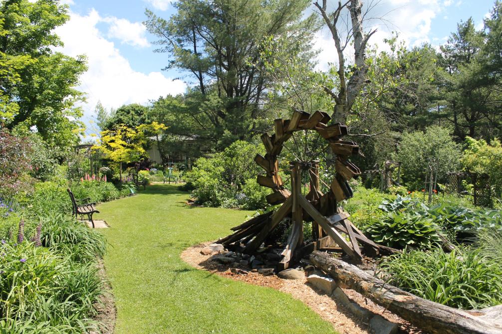
National and regional parks
Four national and two regional parks – an outdoor paradise in the fresh air, each and every one!
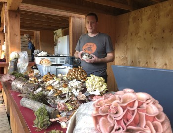
Taste the townships
Here, in so many ways, you’ll enjoy all kinds of gastronomical experiences! When you discover our unique products and our highly renowned tables, you’ll love us forever!
Restaurants
Every time you sit down at one of our tables, you’ll experience a truly special moment. Savour it!
Cafés de village
Visit our Cafés de Village and discover each one’s specialties while meeting the most welcoming and friendly people.
Créateurs de Saveurs Products
You can rely on our food producers who put as much love as delicious flavours into everything they plant and produce.
Vineyards
The Route des vins de Brome-Missisquoi, the Route des vins de l’Estrie, and about twenty other vineyards… The Townships region proudly honours its title of being the first wine region of Quebec.
Microbreweries
The region counts more than twenty microbreweries! Just like the people who run them, each one has established their own strong, unique personality and … extremely inviting character!
Cheese Factories & Dairy Producers
goat’s milk… Here you’ll savour rich artisanal cheeses. Some you already know, many others you’ll enjoy discovering.
Public Markets
Purple peppers, fir honey, pineapple tomatoes … besides all the products you love, sometimes you also discover new, amazingly surprising ones!
Pick-your-own
Pick-your-own farm-fresh fruits and vegetables.
Restaurants Saveurs Cantons-de-l’Est
These restaurants prioritize local producers and offer dishes made with regional ingredients, providing an authentic experience of the Eastern Township terroir.
Foodie’s Maps
Brasseurs des Cantons and Têtes fromagères are two gastronomical circuits highlighting our microbreweries and cheese factories.
Gourmet Itineraries
Plan your stay by offering yourself a wealth of flavours. Consult our getaway ideas.
Weekend and Trip Ideas
Discover our activities suggestions, getaway ideas and itineraries in the Townships.
Family Outings
Find loads of ideas for memorable family outings!
Romantic Getaways
Outings, restaurants, spas, weekend ideas… Suggestions for spending some precious moments together.
Outings with Friends
Gather your crew for a memorable getaway in the Townships!
Outdoor Activities
Hiking, kayaking, beaches, cycling… Without a doubt, all outdoor enthusiasts are sure to find something to do here!
Tourist Routes
Vineyards, mountain peaks, heritage sites… Our designated routes make for the most beautiful road trips!
Itineraries
Whether for two, with your family or with friends, here you will find a ton of suggestions for planning perfect getaways!
Blogs and articles
Our collaborators have tested several different adventures … and have approved!
Coeur villageois
Visit our Cœurs villageois – charming communities that truly characterize the spirit of our region.
Towns and Villages
Explore our lively, welcoming towns and villages with their heritage architecture and fascinating histories.
Guide and Maps
View our guide and maps online or download your free copies.
Westbury Township encircles the town of East Angus. Clearing the area began in 1801 and was mostly completed by the time the town was founded in 1858. Thanks to William Angus, who left Canada Paper in order to open his sawmill and factory, the Township became a local centre for pulp and paper in 1882. At the crossroads of Route 214 and Bassin Sud road, a century-old roadside cross defies time and is a source of pride for local residents.

Restaurants
Les Mal-aimésCookshire-Eaton

Berry picking
CajolerSaint-Isidore-de-Clifton

Berry picking
Ferme au Pré BleuAscot Corner

Locally grown (terroir) shops
Ferme Boucherie Le Sabot d'OrCookshire-Eaton

Local libations
Cidrerie Pomme SauvageCookshire-Eaton

Public and farmers markets
Marché public de DudswellDudswell

Cheese makers and Dairy producers
Fromagerie P'tit PlaisirWeedon

Public and farmers markets
Marché villageois de SawyervilleSawyerville

Honey Producers
Miel Les Butineuses de l'EstrieWeedon
Public and farmers markets
Marché du voisinageCookshire-Eaton

Public and farmers markets
Marché Public de La PatrieLa Patrie

National Parks and Recreational Centres
Parc municipal Walter-MacKenzie (Rivière-au-Saumon)Scotstown
Honey Producers
Miel Les Butineuses de l'EstrieWeedon
Locally grown (terroir) shops
Ferme Boucherie Le Sabot d'OrCookshire-Eaton
Tourist information offices
La Patrie Tourist Information RelayLa Patrie

Tourist information offices
East Angus Tourism OfficeEast Angus

Beaches
P.-E. Perreault beachDudswell

Hiking networks
Lauz AltitudeChartierville

Cross-Country Skiing and Snowshoeing
CLD du Haut-Saint-François / Winter hiking, snowshoeing, and cross-country skiingEast Angus
Cross-Country Skiing and Snowshoeing
Parc régional du Marécage-des-ScotsEast Angus

Cycling
Parc régional du Marécage-des-ScotsHampden (Canton)

Hiking networks
Nature Eastern Townships - Johnville Bog and Forest ParkCookshire-Eaton

Concert Halls and Summer Theaters
Centre culturel de WeedonWeedon

Campgrounds
La Vallée Heureuse du Mont ÉlanWestbury (Canton de)

Bed and Breakfasts
Étang BoisvertCookshire-Eaton

Cottages, Condos and Apartments
Bora Boréal BuryBury

Hotels
Square Victoria Maison HôtelièreEast Angus

Vacation Centres
Domaine Om ShamweLa Patrie

Hotels
Le Pavillon des MésangesDudswell

Cottages, Condos and Apartments
Lauz AltitudeChartierville

Cottages, Condos and Apartments
La GénéreuseCookshire-Eaton
Taste the townships
9 stops
2 days

© 2026, Tourism Eastern Townships. All rights reserved.

Filters
X